“It’s YOUR vacation, so what do you really want to see while you are here?”
I’ve been a guest in new-to-me cities enough times to appreciate that you can’t saddle your hosts with the expectation that they will function as a professional tour guide. It’s unfair to expect someone to magically know what you are interested in seeing and doing, so I’ve learned that to be a good guest, I need to come prepared with a short list of sites and/or events I’d like to see while in their home territory just in case. It’s akin to the “What do you want to eat?-I don’t know, what do YOU want to eat?- I don’t know, what do YOU want to eat?” interaction that most of us dread! So, I think April was relieved when I proposed a road trip north to see Cape Reinga and the Waitangi Treaty Grounds. I was thrilled when she agreed to explore a part of the island she had not yet been to.
Since they are a single vehicle household, and Jitka had to go into work every day, April and I rented a car. It ended up being a cobalt-colored Suzuki Sprint that we lovingly dubbed “Blue Bullet,” and made our way north. We made more stops than just Cape Reinga and Waitangi, but I’ll save those for the next segment of my New Zealand summary 😊
As we drove north along NZ State Highway-1, we were surprised to see huge sand dunes on the Tasman Sea side of the island. Stretching for nearly 6.5 miles along 90-Mile Beach (which is actually only 55 miles), the Te Paki Sand Dunes are nearly 500 feet tall in some places. They stood in such stark contrast to the lush green grass fields and the deep blue Tasman Sea that the “naked” sheep (had apparently been recently sheared) seemed right at home in this uniquely north island landscape.
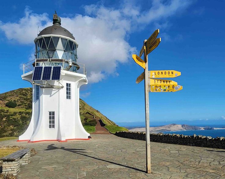
First lit by diesel power and manned in 1941 to replace an 1870s version on nearby Motuopao Island, the Cape Reinga Lighthouse was automated and unmanned in 1987, ultimately becoming solar-powered in 2000. The lighthouse sits at the northern-most tip of the north island, overlooking the convergence of the Tasman Sea and the South Pacific Ocean.
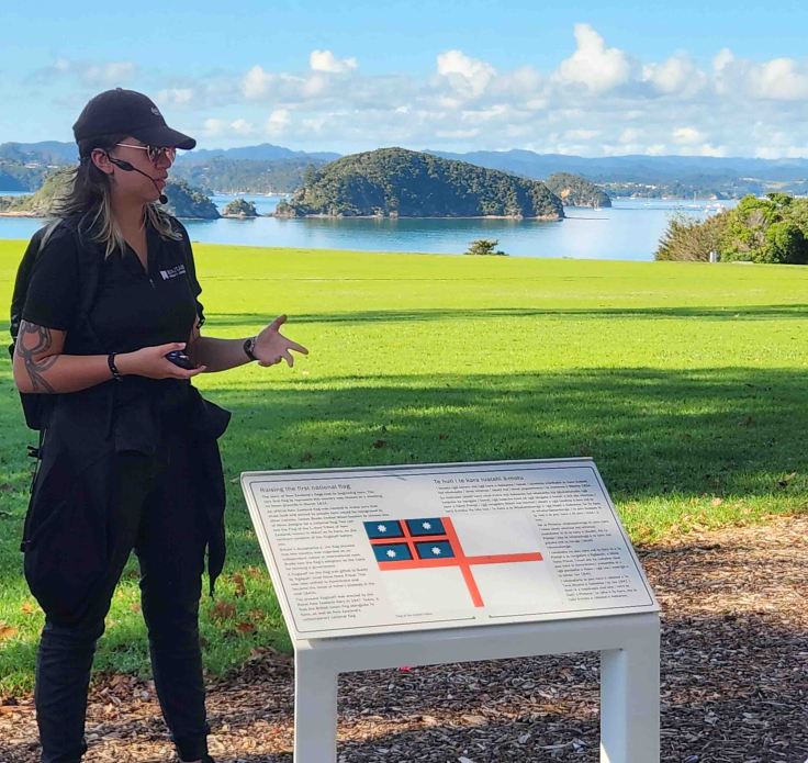
Though a bit steep in some places, the path leading to the Cape Reinga Lighthouse is well-maintained and includes several educational placards along the route. The mass of water behind the street signs is the Tasman Sea.
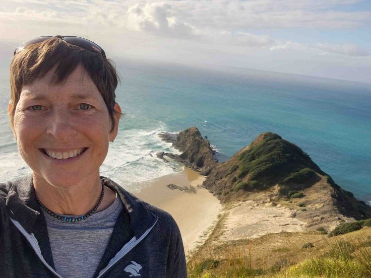
According to Māori history and legend, Cape Reinga is the most spiritually significant place in New Zealand. If you look closely at the island over my shoulder (which is in the South Pacific Ocean), you’ll see a lone, tiny, ancient Pohutukawa tree. According to Māori tradition, after death, their spirits travel to this sacred tree and descend into the underworld by sliding down a root into the sea below to begin their travel to the land of their ancestors.
According to a placard along the lighthouse path, Pohutukawa trees are known for surviving in what seems impossible conditions. Unlike other Pohutukawa trees however, this one has never been known to flower.
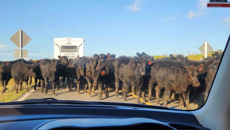
On the way south from Reinga Point, I was just starting to get comfortable driving on the left side of the road when I looked past the next curve and spied what appeared to be livestock jumping down an embankment and onto the road. Sure enough, we had to stop while quad-mounted (four-wheel all-terrain vehicle) cattlemen drove the herd up the road. I’m not sure if the cattle-drive was intentional or not, but the cattle were bigger than the rented “Blue Bullet” and made us a bit nervous!
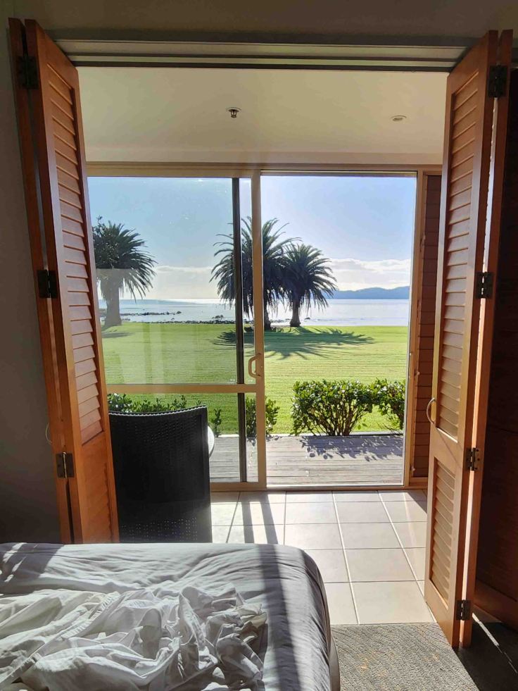
After our twisty, scenic, and livestock-packed road tour of the 62-mile long northern Aupōuri Peninsula, we overnighted at the Copthorne Hotel, within the Waitangi National Trust Reserve. We awoke to this view of Bay of Islands right from our room 😊
Thanks to my friend Daria sending me a book on Māori history a few weeks before my trip, I had already learned about the significance of the Waitangi Treaty of 1840 – an agreement, in Māori and English, that was made between the British Crown and about 540 Māori chiefs which became the founding document for the country of New Zealand. Issues with translation, and the downplay of the effects of British sovereignty over their power, contributed to the chiefs’ support at the time, but has since contributed to calls for re-interpretation as advances in Māori language nuances have highlighted prior imprecisions. As our Māori tour guide at the Waitangi Treaty Grounds explained, the continued use of this internationally recognized circa 1835 United Tribes flag by the Māori people represents their continued belief in self-governance and independence.
This was my second pōwhiri (formal Māori welcome ceremony) since arriving to the island (first one was at the Auckland War Memorial and Museum). It includes chanting and dances that welcome visitors and acknowledge connections to ancestors and the land. At both performances, the orator explained the tradition as it progressed while the personalities of the performers really shone through 😊
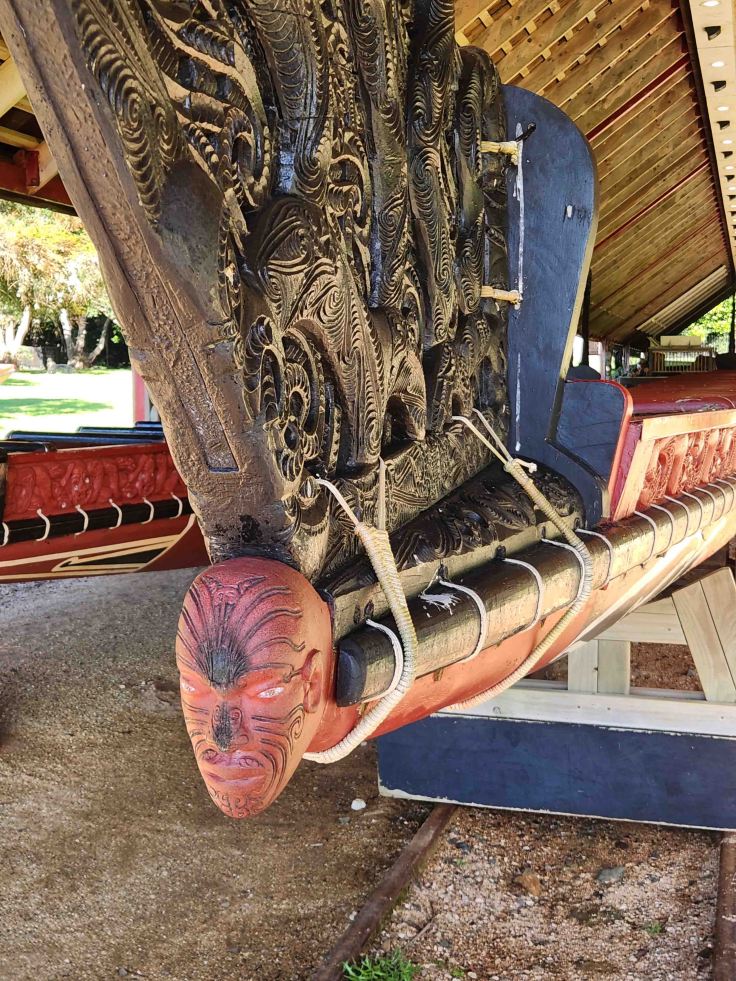
Built in 1940 to commemorate the 100th anniversary of the signing of the Waitangi Treaty, this waka (canoe) named Ngātokimatawhaorua is a third of the length of an American football field and holds around 120 paddlers! It sat dormant on display after its inaugural paddle for over 30 years, but is now launched every year in February as part of Waitangi Day commemorations.
The figurehead on the ceremonial canoe shows evidence of people participating in hongi, the acknowledgement of the breath of life by the pressing of noses and touching of foreheads.
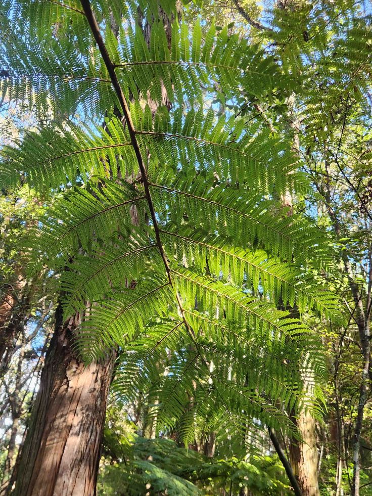
Since the 1880s, the Māori have used the silver fern (it’s a tree!) to symbolize strength, resistance, and power. Over time, it has come to symbolize New Zealand’s national identity and its inhabitants’ attachment to their homeland. It can be found on all things New Zealand, including sport team logos like that of their national women’s soccer team, the Ford Football Ferns.
We took a 50-minute guided tour of the Waitangi Treaty Grounds that included the ceremonial canoe, an intricately carved wooden meeting house, the 1834 Busby house where the treaty was signed, and the meticulously maintained grounds where both the New Zealand and United Tribes flags fly from a historical flagstaff. After the tour, we visited the two museums on the treaty grounds that housed artifacts, and told the stories, of both the events leading up to and after the signing of the treaty, as well as the continued price of citizenship. And of course, we visited the Whare Waka Café, where I had this scrumptious carrot cake and coffee!
Our road trip was not only an excellent way to see more of the island and to learn about its history and culture, it was a great way to spend quality time with April and really catch up. My time on the island had not come to an end yet though, there’s still more shenanigans to catch y’all up on in the next installment, so stay tuned for part 3!


Leave a comment