I woke up and checked the weather on my phone. Hmm, thunderstorms in the afternoon. Whatever, I’m gonna check out a couple of scenic byways anyway. If I get wet, I get wet. Famous last words. . .
Just a few miles from Annapolis, I crossed the Chesapeake Bay via the William Preston Lane, Jr. Memorial Bridge, and picked up the Chesapeake Country National Scenic Byway. Though the U.S. Department of Transportation website states that the byway is 419 miles, the route outlined on the website, and the one I followed, ended up being more like 115 miles between Stevensville, MD and Chesapeake City, MD, including the western leg down to the island that makes up the Eastern Neck National Wildlife Refuge. According to the DOT website, the byway passes through “unspoiled landscape that has shaped the lifestyles and livelihoods of generations of Watermen, shipbuilders, and farmers.”
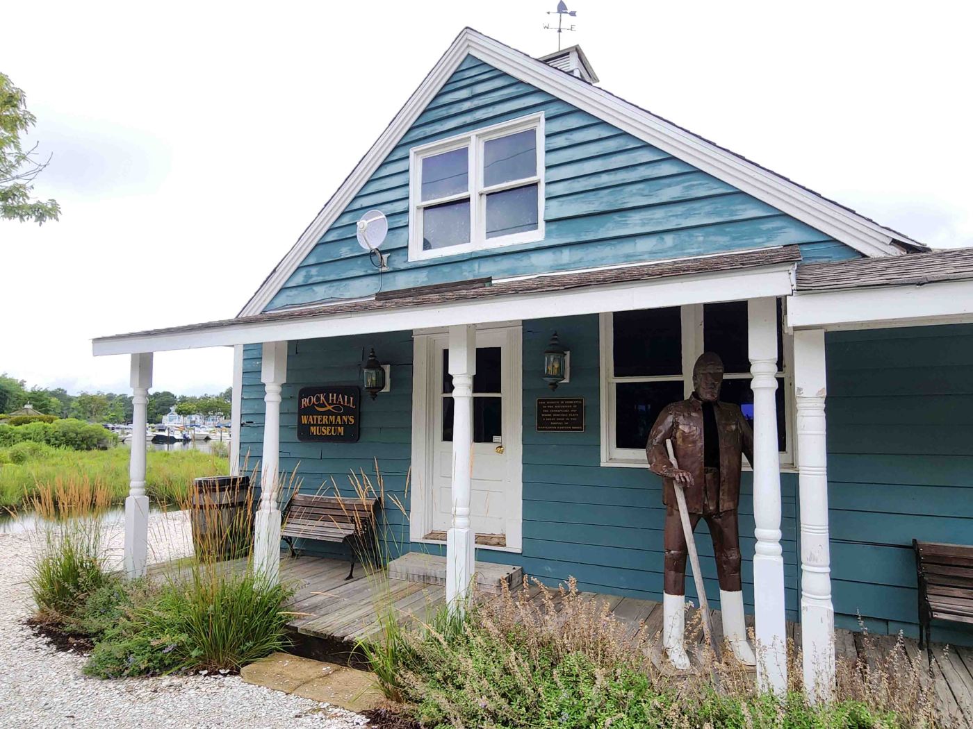
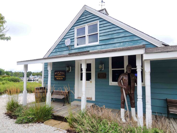
At the end of MD-20 is the harbor town of Rock Hall. This cute eastern shore village is a beautiful mix of maritime vocations and artistry. I stopped by the Waterman’s Museum in Rock Hall to learn more about the seagoing culture of the town. Though unmanned, the key to the museum can be signed-out from the Haven Harbor Marina’s nearby store.
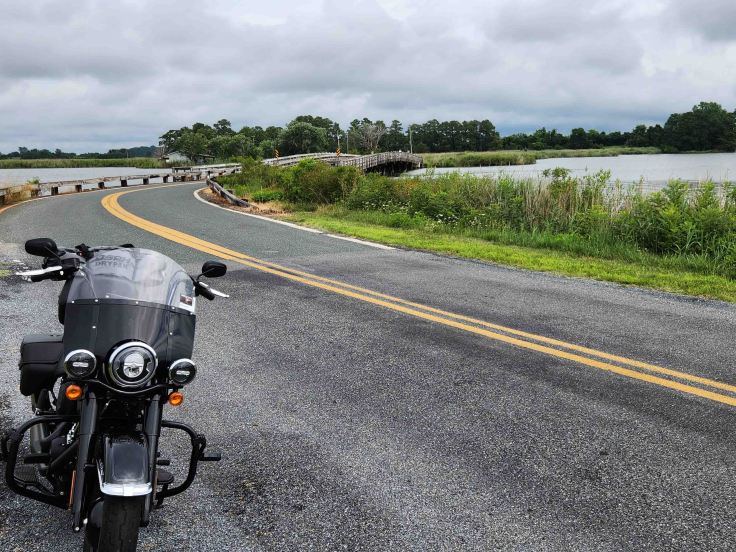
Although the clouds were gathering and looking quite threatening, I decided that I couldn’t be this close to the very end of the road (MD-445) without taking it all the way to its extension, Eastern Neck Island Road via this little bridge, on Eastern Neck National Wildlife Refuge (an island). According to their website, the “Eastern Neck National Wildlife Refuge is a 2,285 acre island providing habitat for thousands of wintering waterfowl, including the tundra swan. Swans feed off of grasses in the river and narrows as do the waterfowl. Eastern Neck refuge supports a wide variety of habitats including brackish marsh, natural ponds, upland forest, and grasslands. The refuge holds the designation of Important Bird Areas by the Audubon Society. Over 240 bird species visit the refuge along with small mammals and many other wildlife species.” In case you’re wondering, like I was, the island is called a “neck” because the long, thin stretch of land looks like a neck on a map. The refuge was beautiful, and actually reminded me quite a bit of Louisiana marshes, mosquitoes and all!
Though I continued to sightsee and enjoyed the roll through farmlands dotted with farm houses for the remainder of the byway up to Chesapeake City, I picked up the pace a bit to make it over to the Court House Museum in New Castle, Delaware before they closed, and to try to beat the inevitable thunderstorm coming. I did manage to make it to the museum before closing, but as you can see, I did not succeed in outrunning the rain
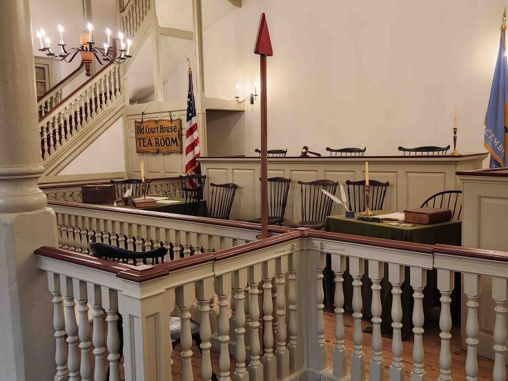
Part of the First State National Historical Park, the courthouse was home to the Delaware legislature that voted for independence from Great Britain in 1776. This building, and the first state in the union however, turned a blind eye to liberty for all when, in 1848, abolitionists Thomas Garrett and John Hunn were tried on federal charges, and found guilting, in this very courthouse for violating the Fugitive Slave Act for helping enslaved people find their way along the Underground Railroad. Unfortunately, I was unable to tour the museum because a very large group was scheduled and showed up for a private tour right after I had arrived.
The town of New Castle is the northern terminus for the Delaware Bayshore Byway, so I had intended to explore a few other First State National Historical Park locations and a few of the beach towns on the way to my lodging at Dover Air Force Base, but heavy rains and limited NPS historic site operating days/times thwarted my efforts. I was so soaked by the time I arrived at lodging for the night that I literally left a pool of water in front of the check-in desk. That’s OK though, the sky cleared by the next morning and provided a gorgeous day for me to explore the remainder of Delaware’s byway and the next scenic route on my list: New Jersey’s Bayshore Heritage Byway.
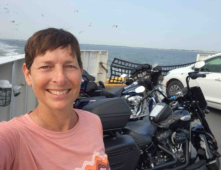
I rode down to Lewes, Delaware, where I caught the 1.5-hour ferry across Delaware Bay to Cape May, New Jersey. My bike ran great during the 60-minute trip to the ferry terminal, but when the deckhand pointed to me to load my bike on the ferry ahead of all the cars, it wouldn’t start (I was the only bike on that ferry, this pic is of the ferry ride back to Lewes, DE from Cape May, NJ which had one other rider). I had power, but nothing happened. Finally, on the 4th or 5th try with all the four-wheel drivers impatiently looking on, my bike started and I rolled onto the ferry and parked near the bow. I suspected that the thorough drenching that my bike and I experienced the day before might have shorted out a circuit somewhere, so I called Mike, my phone-a-friend motorcycle expert, for guidance. Within 30 seconds, he diagnosed that the neutral safety switch had shorted out, so I needed to follow the correct start-up procedure and put my bike in neutral before pressing the starter switch. Yes, I’m lazy and just pull in the clutch when starting the bike instead of putting the bike in neutral. As usual, he was right and saved my a$$!
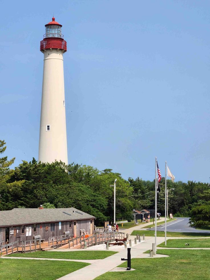
I rolled off the ferry and into New Jersey, then rode the couple miles to Cape May Point State Park. The Cape May Lighthouse opened in 1859 and stands sentinel above the Delaware Bay and the Atlantic Ocean.
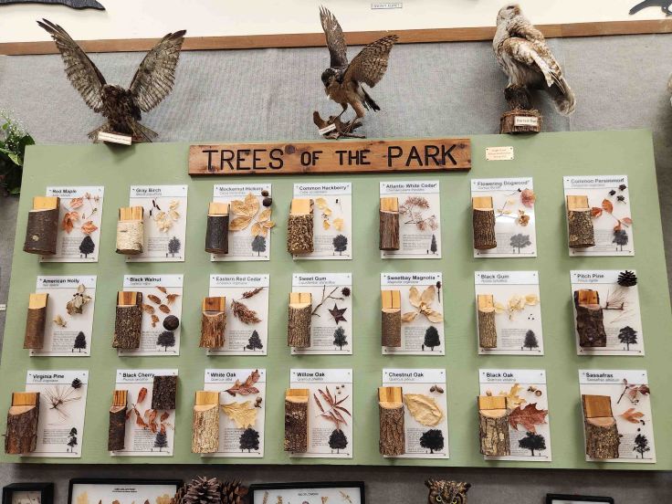
I rode several miles on the Bayshore Heritage Byway before transitioning over to New Jersey’s Pine Barrens Byway. After always having had a strictly urban perception of New Jersey, I was stunned by the beauty of the Pinelands National Reserve. Called “pine barrens” by early settlers because they couldn’t grow traditional crops in the sandy, fast-draining, acidic soil, this area is anything but austere. I rode through forests of pitch pine, oak, and Atlantic white cedar as well as cranberry bogs (though it was too early to see any cranberries), tea-colored rivers, meadows, white sand, and a few villages. I stopped by the visitors center at Estell Manor County Park and was really impressed with this Eagle Scout project showcasing native trees displayed in their education center. So much to see and learn!
Since I hadn’t made the decision to ride into New Jersey until the night before, I didn’t have much time to coordinate meeting with my friend Sarah, who I had met two years ago at my first Babes Ride Out women’s motorcycle camping event in New York. I remembered that she lived in New Jersey, so I shot her a quick message that I was riding in her state. She immediately messaged back and we figured out a waypoint for us to meet for lunch. We both have new motorcycles since the last time we rode together, so we had a lot of catching up to do!
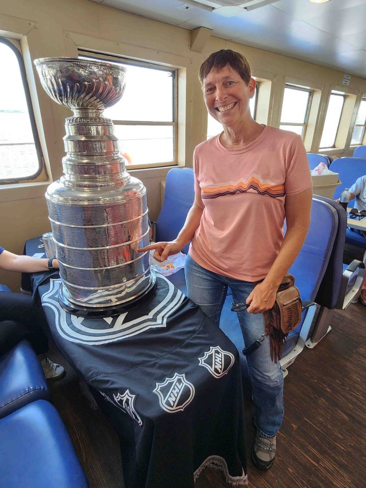
Before I knew it, my day in New Jersey had come to an end and I again loaded my bike onto the ferry, but this time without starter mishaps! Once my bike was safely stowed on deck, I went up to the indoor dining section to get a bite to eat. As I sat down with my snack, I looked up to see what I could’ve sworn was the National Hockey League Stanley Cup sitting atop a table a few yards from me. Sure enough, the Cup was travelling to the hometown of one of the staff of the Vegas Golden Knights, who was having her turn to take the Cup on a tour, accompanied by several other staff. According to HockeyAnswered.com, “each championship team is allowed to put up to 52 names on the cup that includes players, coaches, management, and staff.” The folks travelling with the Cup, helped me find my friend Paul’s name, who was the head Strength and Conditioning Coach, and Dietitian, for the 2001 championship team (I’m pointing to it in the pic)!
With my scenic drives of Delaware and New Jersey complete, I decided to head north-west for a little more sightseeing and history. Next up: American Civil War era history.


Leave a comment