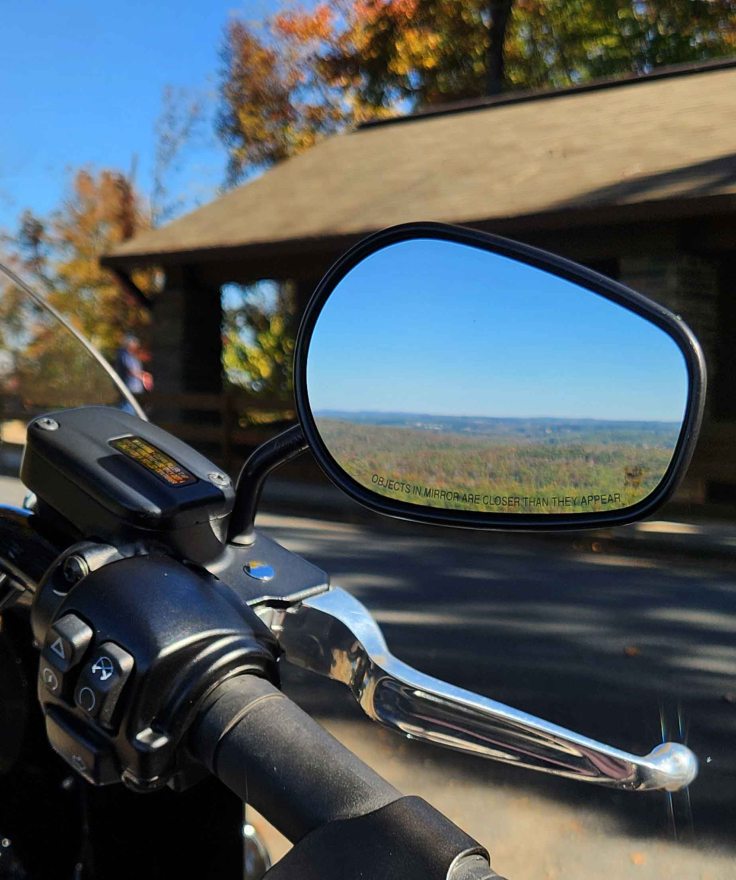
North Carolina has 41 state parks. At least a dozen of them are close enough to my home for day trips, so I occasionally choose one for a motorcycle destination. Whether on two or four wheels, I typically will do a hike while I’m there. With the gorgeous recent weather, I’ve visited five of them in the last couple of weeks for a little leaf-peeping and test runs for my new hip. Pilot Mountain, Hanging Rock, Morrow Mountain, Raven Rock and Jones Lake were all sporting fall foliage, to different degrees, so I had to check them out!
The state of North Carolina is divided into three geographic regions – Mountain, Piedmont, and Coastal Plains.
MOUNTAIN REGION
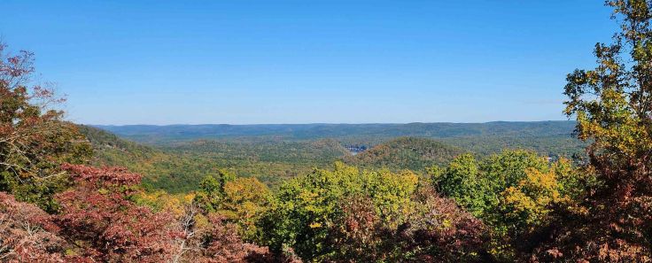
The Mountain Region is home to the Blue Ridge Mountains and the Great Smoky Mountains. Both are part of what’s possibly the oldest mountain range in the U.S. – the Appalachian Mountains. The peak ridges of the Blue Ridge Mountains form the Eastern Continental Divide. Rivers on the eastern side of the Blue Ridge flow towards the Atlantic Ocean. Waterways to the west dump into Tennessee and Ohio Rivers, and ultimately, into the Gulf of Mexico. The Mountain Region is also home to the highest peak east of the Mississippi River – Mount Mitchell. (NC Sec of State) I visited three of this region’s state parks: Pilot Mountain, Hanging Rock, and Morrow Mountain.

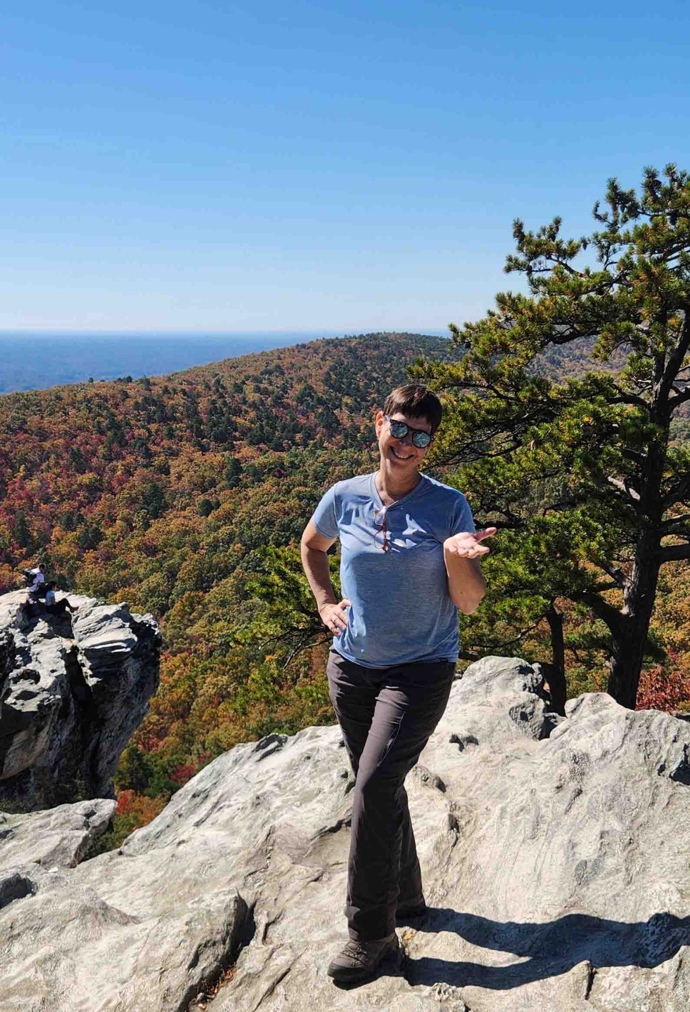
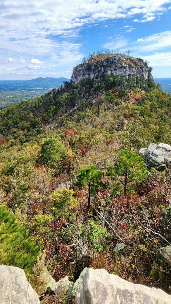
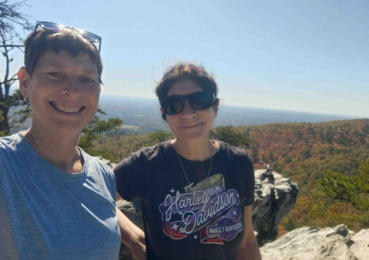
Pilot Mountain State Park
Located 20 miles northwest of Winston-Salem, this park highlights the iconic geologic knob called “Jomeokee” by the Saura (aka Cheraw) people, which means “great guide” or “pilot.” It’s distinctive shape, rising some 1,400 ft above the surrounding area, made it a perfect navigational aid for centuries. (NC Parks & Recreation and History of Pilot Mtn)
Hanging Rock State Park
Approximately 20 miles northeast of Pilot Mountain, Hanging Rock State Park provides sweeping views of the Dan River Valley. Though the Civilian Conservation Corps’ contributions to state and national parks between 1933 and 1942 is found throughout the U.S., their involvement in the development of Hanging Rock is still felt through enduring structures such as a dam (and the small lake it impounded), shelters, roads, picnic areas, and even a bathhouse that has been added to the National Register of Historic Places. (NC Parks & Recreation and NCpedia)


Morrow Mountain State Park
Positioned about 50 miles northeast of Charlotte, Morrow Mountain State Park provides access to the Yadkin and Peedee Rivers, and Lake Tillery while also offering spectacular views of Badin Lake and the surrounding area. (NC Parks & Recreation)
PIEDMONT REGION
Piedmont is a French word for “foot of the mountain.” In North Carolina, the Piedmont region ranges in elevation from 300 feet in the east, to 1,500 feet at the base of the mountains in the west. Not quite sea level, and not really mountainous, this region is known for its “rolling hills, rivers, streams, forests and farms.” (NC Sec of State and Piedmont Land Conservancy) I visited one of the state parks in this region: Raven Rock.
Raven Rock State Park
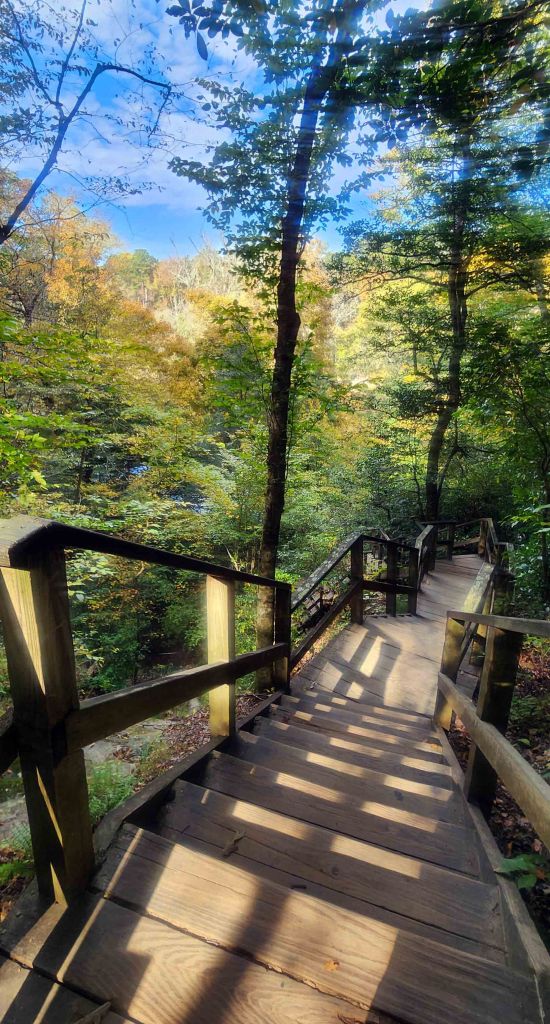
Raven Rock State Park is situated 40 miles southeast of Raleigh. The namesake of the park is a 150-foot crystalline structure that overlooks the Cape Fear River. Even though the park spans both sides of the Cape Fear River, there are no boat launches; the only water access is from hiking trails (NC Parks & Recreation)

COASTAL PLAINS REGION
The Coastal Plains Region is made up of the flat, sea level land stretching from the sandy Piedmont farmlands to the Atlantic Ocean. The mouths of major rivers and streams empty into the tidewater area’s sounds (narrow bodies of water that connects to a sea or ocean). In addition to multiple sounds, this region is home to barrier islands, wetlands, swamps, farmland, and longleaf pines. (NC Sec of State and NCpedia) I visited only one of the state parks found in this region: Jones Lake.
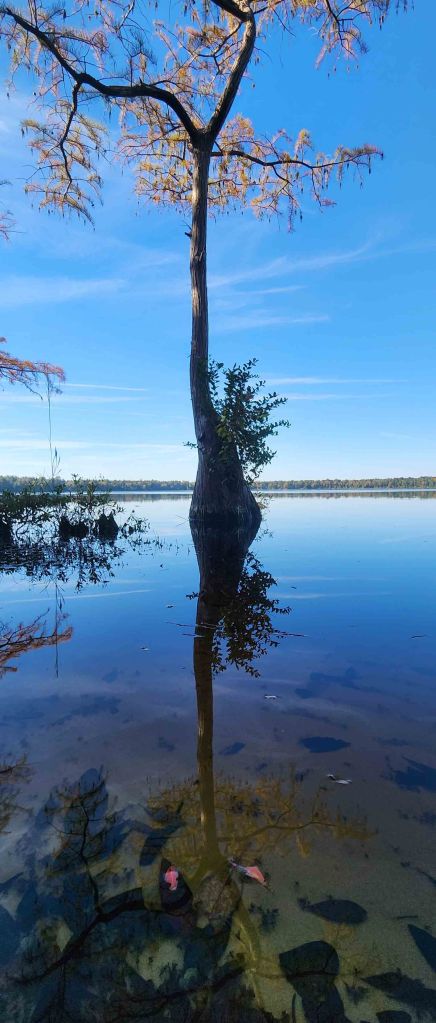
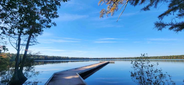
Jones Lake State Park
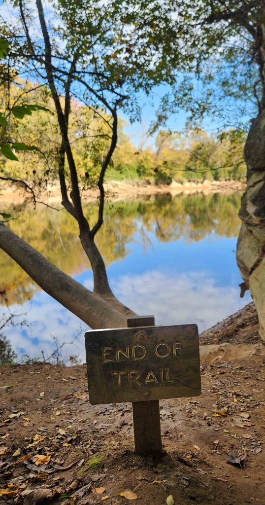
Found 40 miles southeast of Fayetteville, Jones Lake State Park is home to one of the thousands of perfectly rounded, sand-rimmed lakes found in the southeastern corner of the state. The lakes are mysterious geological formations known as Carolina Bays, a series of elliptical depressions along the Atlantic coast, whose origins are unknown. In 1939, Lake Jones opened as the first state park for African-Americans. (NC Parks & Recreation and Our State Magazine)

So far, I have visited 24 of North Carolina’s 41 state parks. Living in the Piedmont region perfectly positions me for exploring the mountains to the coast. Whether it’s via 2-wheels or 4, a hike through nature upon arriving at one of these jewels always fills me with gratitude and awe at the diversity within the state park system. In the last couple of weeks, I was able to explore trails in the mountains, over and under iconic rocks, and around mysterious lakes. I’m hoping to trek through the remaining dozen or so parks I’ve yet to discover once I’m done getting all my replacement parts.
How many parks does your state have? Do you have a favorite?

How far are you from the Hurricane Helene disaster?
Chief
LikeLike
Most of the destruction was about 2 hours west of where I live. The parks in the Mountain Region that I visited are the ones farthest to the east and weren’t affected as much.
LikeLike
O-TAY! Ain’t wishing anything bad on other people, but I’m glad you are safe and sound.
Chief
LikeLiked by 1 person