I’m often asked how I find so many scenic routes with interesting sites along the way. Most states put out print and/or online scenic byway guides; a few states even produce motorcycle specific ones. Some tourism maps are better than others, so I was pleasantly surprised at the depth of details and quality aesthetics of the Louisiana Scenic Byways website. The state has 19 scenic byways, each with its own page. For my travel north, I rode parts of both the Toledo Bend National Forest Scenic Byway and the Boom or Bust National Scenic Byway.
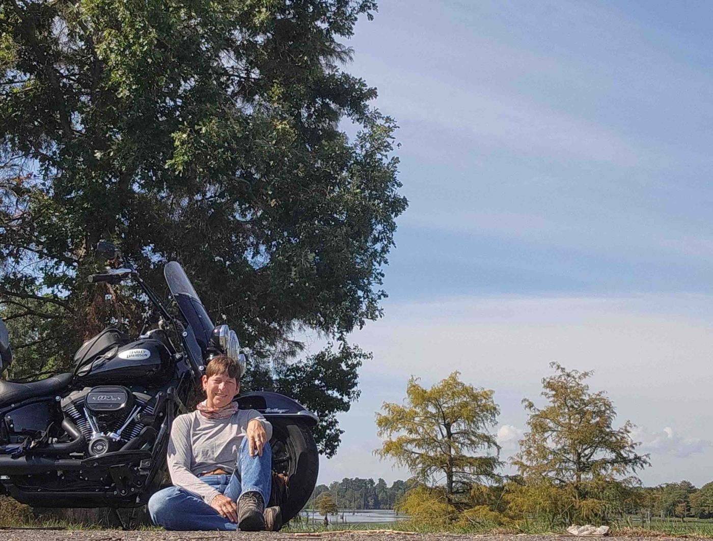
I stopped for a rest break at San Patricio Overlook along the 78-mile Toledo Bend National Forest Scenic Byway in west-central Louisiana. The byway, LA-191, follows the Louisiana-Texas border through pine and hardwood forests, reservoirs, parks, and scenic overlooks.
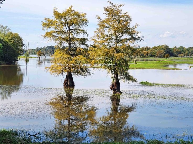
Gorgeous Cypress trees (behind me in the above photo) along the Choctaw Branch of Toledo Bend Reservoir.
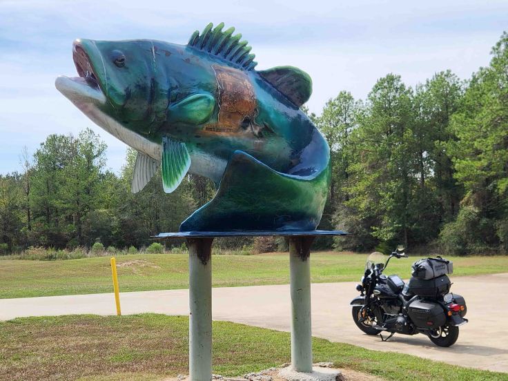
Welcome to Desoto Parish, Louisiana! I passed this huge fish along the Toledo Bend National Forest Scenic Byway and turned around to check it out. It’s on the edge of Logansport, which hosts an annual bass tournament. Random sites like this is what keeps me on the backroads 😊
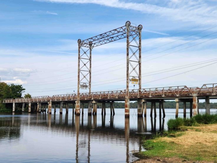
Built in 1914, the Historic Caddo Lake Drawbridge in Mooringsport, LA on LA-169 is of the classic vertical-lift style, and is listed in the National Register of Historic Places. The center span lifts vertically to allow tall boats and oil industry equipment to pass under it. According to the bridge website, “In the summer of 1941, just prior to WWII, the U.S. Army held maneuvers in and around Mooringsport as a means of preparing the soldiers for war. During the maneuvers, Generals Dwight D. Eisenhower and George S. Patton came to Mooringsport and led the Red and Blue armies in the “capture” of the bridge. They also bombed the bridge with sacks of flour.” As I rode across the bridge, I imagined what it must’ve looked like after the flour bombing!
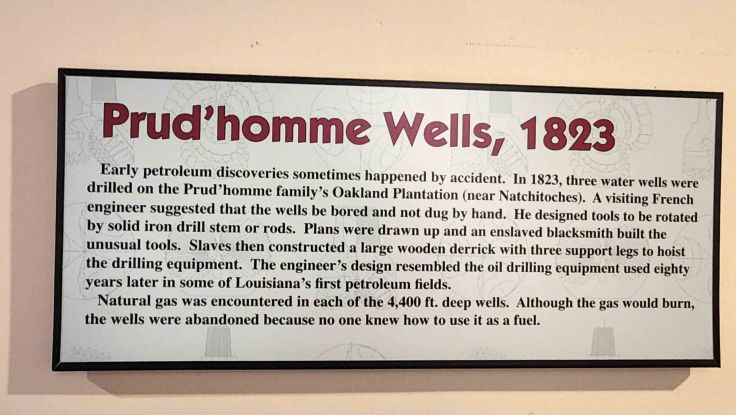
The 137-mile Boom or Bust National Scenic Byway “tells the universal American story of the dramatic ups and downs in the oil and gas, lumber, transportation, farming and entertainment businesses over the decades that produced both the best and the worst of times. It represents a microcosm of American history experienced throughout the U.S. in the 18th through 20th centuries.” The Louisiana State Oil and Gas Museum tells the petroleum industry’s role in the state’s ongoing boom or bust story.
An exhibit on the earliest discoveries of fossil fuels in the state ties the cotton producing Oakland Plantation in Natchitoches and its enslaved labor force to Louisiana’s shift to a more industrial economic base.
I crossed the border from Louisiana to Arkansas (via a short jaunt into Texas) and continued north. Named after the three bordering states of Texas, Arkansas, and Louisiana, Texarkana is two separate municipalities- one in Texas and one in Arkansas. “The State Line Post Office and Federal Building is the only U.S. post office situated in two states.” (Texarkana Tourism website)
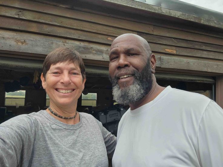
I was 0 for 3 on my Bunk-a-Biker requests this trip (everyone was dealing with life events or were on the road themselves), so I was excited when I heard back from Mike that he was available and happy to host me as I passed through Texarkana. He grilled up delicious steaks and provided a comfortable, welcoming stop on my journey. Looking forward to our paths crossing again in the future and swapping more travel stories!
Mike and I both took off from his place the next morning, headed in opposite directions. I donned rain gear and headed into the showers looming over my path to the east, undeterred by the inevitability of getting wet. It’s all part of the adventure! More National Park Service units and epic roads coming up 🙂


😜🥰🏍️
LikeLiked by 1 person
Those cypress trees are gorgeous. Interesting photos, thanks for sharing! 🏍️
LikeLiked by 1 person